|
  
|
 |
|
 Antarctic
Polar Regions | The Continent and its Islands Antarctic
Polar Regions | The Continent and its Islands
Antarctic ice covers 98%
of the continent
Ever since satellite observations produced their first results (at the end of the 1970s) and since Antarctica has constantly been covered by radar - if only on account of the hole in the ozone layer - there are practically no more black spots regarding the geographic contours of the continent, despite the fact that the Antarctic coastline is covered by thick tongues of ice that stretch far out to sea.
By contrasts, the same does not apply to the interior, a vast ocean of ice, where only the rocky summits emerge from the ice-cap (called Nunataks); they are visible in the transantarctic range (separating eastern Antarctica from western Antarctica), in the Ellsworth mountains and in a whole series of more modest mountainous areas forming a belt around the continent approximately 200 kilometres from the coast. Except for the few valleys where the ice does not accumulate, these outcrops represent scarcely 2% of the continent's surface area. Nevertheless the most characteristic feature of relief on the continent remains linked to the fact that the majority of Antarctica's land lies hidden under a layer of ice that average 2,300 metres in depth. Which gives the floor of the polar plateau a height greater than for all the other continents. The highest point of the ice is located not far from Adélie Land, reaching a height of 4,776 metres (the South Pole is only at an altitude of about 3,000 metres); the weight of the ice-cap is such that in some places, the rocky base has been pushed back into the Earth's crust to a depth of up to 2,500 metres below sea level. Except for the few valleys where the ice does not accumulate, these outcrops represent scarcely 2% of the continent's surface area. Nevertheless the most characteristic feature of relief on the continent remains linked to the fact that the majority of Antarctica's land lies hidden under a layer of ice that average 2,300 metres in depth. Which gives the floor of the polar plateau a height greater than for all the other continents. The highest point of the ice is located not far from Adélie Land, reaching a height of 4,776 metres (the South Pole is only at an altitude of about 3,000 metres); the weight of the ice-cap is such that in some places, the rocky base has been pushed back into the Earth's crust to a depth of up to 2,500 metres below sea level.
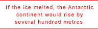 If the ice-cap were to melt, Antarctica would rise up be several hundred metres (a phenomenon call the isostatic rise), exactly like a boat being unloaded. By analogy, this calculation is based on the fact that since the end of the last ice age (20,000 years ago), Scandinavia has risen at the rate of a metre a century. It is these observations that when coupled to the geological studies described earlier and plate tectonics, led to Antarctica being cut in two; the eastern section, massive and continuous, and the western section, which was probably formed more recently (200-150 million years ago, compared with 3 billion for its neighbour) and located to the west of the transantarctic range, smaller in area and made up of a series of archipelagoes that the ice welds together. These archipelagoes under the ice produced the Antarctic peninsula, which is often considered as the third section of the continent. If the ice-cap were to melt, Antarctica would rise up be several hundred metres (a phenomenon call the isostatic rise), exactly like a boat being unloaded. By analogy, this calculation is based on the fact that since the end of the last ice age (20,000 years ago), Scandinavia has risen at the rate of a metre a century. It is these observations that when coupled to the geological studies described earlier and plate tectonics, led to Antarctica being cut in two; the eastern section, massive and continuous, and the western section, which was probably formed more recently (200-150 million years ago, compared with 3 billion for its neighbour) and located to the west of the transantarctic range, smaller in area and made up of a series of archipelagoes that the ice welds together. These archipelagoes under the ice produced the Antarctic peninsula, which is often considered as the third section of the continent.
|