|
|

|
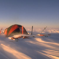
Why
do winds and blizzards have such a bad reputation in Antarctica?
Because they are the strongest winds anywhere in the world.
Without going into too many scientific details, it can be said
that the incredible strength of these winds is linked to the extreme
cold in Antarctica. The colder the air is, the heavier it becomes.
 It becomes even heavier when it starts moving under the effect
of the inclines of the polar ice-cap. This is the reason why they
are called katabatic winds (from the Greek, kata, downwards).
The blizzards are the most violent near the coast where the slopes
become steeper. Another corollary strengthens the winds even further:
the formation of approximately 1000 metres of a shaft of warm
air at an altitude (extreme cooling of the air on the ground means
that layers of air warm up at an altitude), which blocks the usual
rising air. This means that the layers of air are pinned to the
ground by this "lid" above, and as they have to respond to other
forces, they begin to move in different directions from normal,
usually upwards
It becomes even heavier when it starts moving under the effect
of the inclines of the polar ice-cap. This is the reason why they
are called katabatic winds (from the Greek, kata, downwards).
The blizzards are the most violent near the coast where the slopes
become steeper. Another corollary strengthens the winds even further:
the formation of approximately 1000 metres of a shaft of warm
air at an altitude (extreme cooling of the air on the ground means
that layers of air warm up at an altitude), which blocks the usual
rising air. This means that the layers of air are pinned to the
ground by this "lid" above, and as they have to respond to other
forces, they begin to move in different directions from normal,
usually upwards
The study of these katabatic winds has been
carried out with particular care in preparation for the expedition.
Because if we could highlight two factors which will be the gauges
for this trans-Antarctic attempt succeeding or failing, they would
be, first, the winds (presence, strength, direction, duration,
etc.) and second, the use that can be made of them with the parafoil.
Winds
gusts
of 320 Km/h
Have been
recorded on
Antarctica |
That is why the co-operation between the
expedition and the Belgian researcher, Hubert Gallée (UCL)
has been so close; Gallée will in fact use his mathematical
model on katabatic winds to enter new data provided by the expedition,
let the computer work on it and then after days of calculations
(that the computer generates by itself once the ad hoc data has
been entered), produce new simulations for the winds (strength and
direction) and temperatures throughout the assumed route of "South
Through the Pole 1997-98" - at any time of the day or night.
This is how the route was finally decided; the reason why Hubert
and Dansercoer have opted for the Axel Heiberg glacier and down
the polar plateau towards the Ross Sea (which does not appear to
be the shortest route), is because the simulation produced by Gallée's
mathematical model shows that the winds are likely to be of better
quality and blowing in a more favourable direction all along that
route.
The wind-chill factor
In addition to the direct dangers it presents, the wind also increases
the effect of the cold and makes the mercury plummet. The table
below presents clearly some examples of equivalent temperatures
when they are subjected to the wind-chill factor.
|
|
Temperature
(°C) |

|
|
0
|
-5
|
-10
|
-15
|
-20
|
-25
|
-30
|
-35
|
-40
|
-45
|
-50
|
| 80
|
-20 |
-28 |
-36 |
-44 |
-52 |
-60 |
-68 |
-76 |
-84 |
-92 |
-100 |
| 70
|
-19 |
-27 |
-35 |
-43 |
-51 |
-59 |
-67 |
-75 |
-83 |
-91 |
-99 |
| 60
|
-19 |
-26 |
-34 |
-42 |
-50 |
-58 |
-66 |
-73 |
-81 |
-89 |
-97 |
| 50
|
-18 |
-25 |
-33 |
-40 |
-48 |
-56 |
-63 |
-71 |
-79 |
-86 |
-94 |
| 40
|
-16 |
-23 |
-31 |
-38 |
-45 |
-53 |
-60 |
-68 |
-75 |
-82 |
-90 |
| 30
|
-13 |
-20 |
-27 |
-34 |
-41 |
-48 |
-55 |
-62 |
-70 |
-77 |
-84 |
| 20
|
-10 |
-16 |
-23 |
-29 |
-35 |
-42 |
-48 |
-55 |
-61 |
-68 |
-74 |
| 10
|
-3 |
-9 |
-15 |
-20 |
-26 |
-31 |
-37 |
-42 |
-48 |
-53 |
-59 |
You can see from this table that if for example the actual temperature
is -20° and the wind is blowing at 56 km/h, the equivalent
temperature becomes -47°; and if the actual temperature is
-40°, with the wind blowing at 80 km/h, which is common enough
in polar territory, the equivalent temperature becomes -84°,
and so on.
|